Geologic Features of a Seamount Exploration
Your Objective
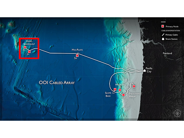
Use depth and angle (tilt from side to side) data of the seafloor from 3 locations on the Axial Seamount in the Northeast Pacific Ocean (Cabled Axial Seamount) to look if there are patterns over 7 months in 2015.
- Make a prediction about what kind of changes or patterns in seafloor depth and angle you may observe over time.
- Explore the data below to see what you can observe.
Include datasets:
Data Tips
When the site loads, you are able to see the seafloor depth and angle (tilt) in the X (east-west) and Y (north-south) directions from 7 months in 2015 at the Axial Seamount. You can interact with the data by:
- Zooming in and out of the data to look at different time scales that interest you by changing the width of the highlighted section of the bottom graph (it loads with all of the data highlighted).
- Selecting a different part of the time series to explore the data in ways that interest you by moving the highlighted section of the bottom graph to the right or left.
- Adding a different location of instruments at the seamount by selecting the other locations.
Note - Tilt values are in microradians. One microradian is the amount of angle you'd get if you lifted one end of a straight line that is 1 km long by 1 mm.
Questions for Thought
- Across what time period are you able to observe depth and angle (tilt from side to side) data of the seafloor in these graphs?
- What is the first month there are data?
- What is the last month there are data?
- In what direction (North, South, East, or West) is the angle of the seafloor when there is a negative X-tilt? A negative Y-tilt?
- What changes or patterns did you observe in seafloor depth over this time period at the Axial Seamount?
- When did you see these changes or patterns?
- What changes or patterns did you observe in seafloor angle over this time period at the Axial Seamount?
- When did you see these changes or patterns?
- What questions do you still have about why the depth and angle of the seafloor changes over time?
Background Information
Click on the images below to learn more about where and how the dataset above was collected.

Additional Resources
- Want to convert microradians into degrees? You can use an online unit converter.
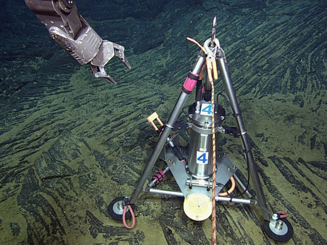
- Learn how the Bottom Pressure and Tilt sensor measures changes in the seafloor in this Video Blog #9 "Pressure Measurements" from the NOAA Earth-Oceans Interaction Program 2015 cruise to Axial Seamount.
Dataset Information
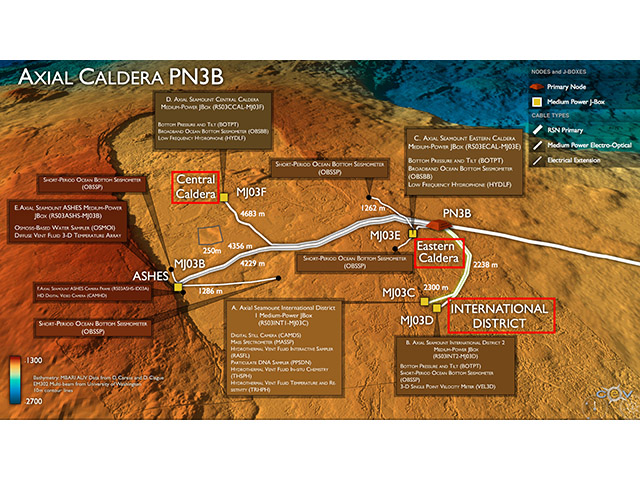
The data for this activity was obtained from the following Bottom Pressure and Tilt instruments on the Cabled Axial Seamount array:
- Central Caldera (RS03CCAL-MJ03F-05-BOTPTA301)
- Eastern Caldera (RS03ECAL-MJ03E-06-BOTPTA302)
- International District Vent Field 2 (RS03INT2-MJ03D-06-BOTPTA303)
The above datasets were downloaded from the OOI data portal and downsampled to simplify the datasets for plotting. Special thanks to William Chadwick for assistance in the processing these data. For more information about these data and past events, please check out NOAA PMEL's site on Bottom Pressure and Tilt instruments at Axial Seamount.