Magma Movement and the Shape of the Seafloor Exploration
Your Objective
Use earthquake and bathymetry data from before and after an underwater eruption to see how they are related.
- Explore the data to see what observations you can make.
- Describe the possible relationship between the earthquakes and changes in seafloor topography.
- What do the earthquake and bathymetry data tell you about magma movement within the volcano?
Zoom:
Show:
Data Tips
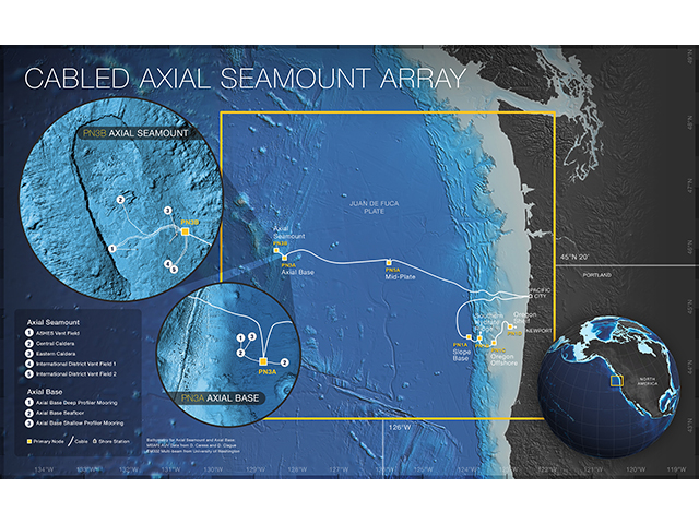
When the site loads, you are able to see the full datasets of bottom pressure, depth, and earthquakes at Axial Seamount. The data was collected using the Cabled Axial Seamount Array in the northeastern region of the Pacific Ocean. You can interact with the data by:
- Toggling between the raw and processed bathymetry data.
- Zooming in and out of the data to look at different time scales that interest you by changing the width of the highlighted section or dragging the highlight box.
Questions for Thought
- What oceanic or geologic variables can you look at in these graphs?
- Across what time periods are you able to observe oceanic or geologic variables in these graphs?
- What is the first month and year there are data?
- What is the last month and year there are data?
- What is general depth range?
- What is the range of earthquake magnitude?
- What changes or patterns did you observe in the earthquake data?
- What changes or patterns did you observe in the bathymetry data?
- What relationships did you see between the earthquake and bathymetry data?
- What changes or patterns indicate the eruption of the volcano?
- Why do you think there is a difference between the number of earthquakes before and after the eruption?
- As you think about magma within the volcano, how might the movement of the magma influence the behavior of the earthquakes before, during, and after the eruption? How might the movement of the magma influence the bathymetry?
- What questions do you still have about what drives changes in the seismicity and/or bathymetry over time at Axial Seamount?
Background Information
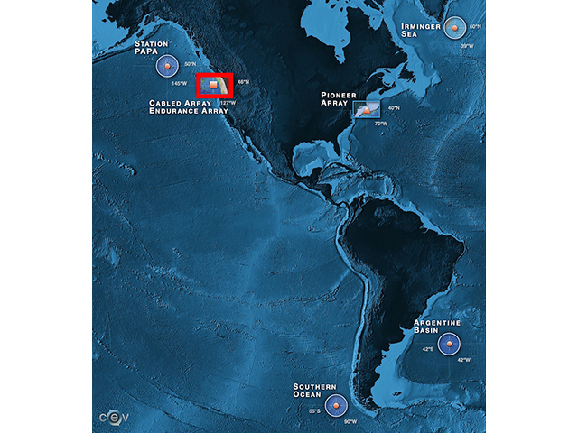
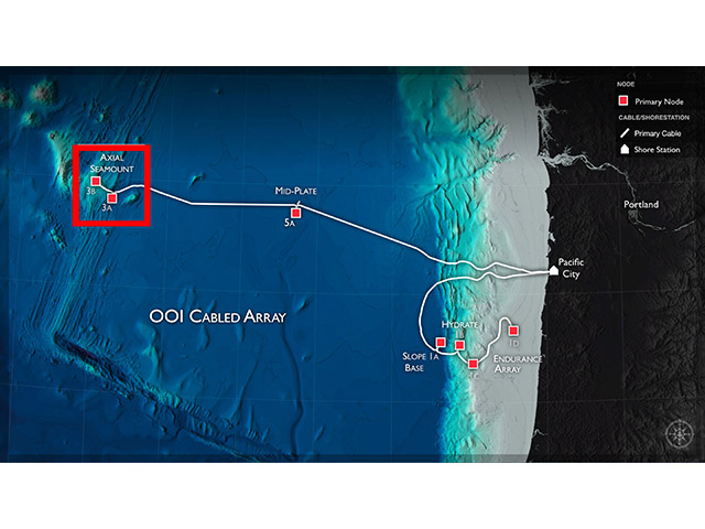
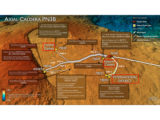
Click on the images below to learn more about where and how the dataset above was collected.
Dataset Information
Download: Depth Data Earthquake Data
The pressure/depth data in this activity was provided by William Chadwick at NOAA PMEL and was collected by the Central Caldera Bottom Pressure and Tilt instrument (RS03CCAL-MJ03F-05-BOTPTA301) on the Cabled Axial Seamount Array.
- The following Jupyter Notebook demonstrates how you can (crudely) process this dataset yourself.
- To see the latest data from this instrument, you can check out Bottom Pressure and Tilt page at NOAA PMEL. They also provide a blog that chronicles past and future diking-eruption event forecasts at Axial Seamount.
- Nooner, S. L., and W. W. Chadwick, Jr. (2016), Inflation-predictable behavior and co-diking-eruption event deformation at Axial Seamount, Science, 354(6318), 1399-1403, doi:10.1126/science.aah4666
The earthquake data was provided by William Wilcock via the Axial Seamount Earthquake Catalog.
- Wilcock, W., Waldhauser, F., & Tolstoy, M. (2016). Catalogs of earthquake recorded on Axial Seamount from January, 2015 through November, 2015 (investigators William Wilcock, Maya Tolstoy, Felix Waldhauser). (Version 1) [Data set]. Integrated Earth Data Applications (IEDA). https://doi.org/10.1594/ieda/323843. The earthquake catalog data are publicly available in the Marine Geoscience Data System. The data used are from the file Axial_DD_n12.dat.
- To learn more about this diking-eruptive event, see Wilcock, W., M. Tolstoy, F. Waldhauser, C. Garcia1, Y. Joe Tan, D. Bohnenstiehl, J. Caplan-Auerbach, R. Dziak, A. Arnulf, and M. Mann. (2016) Seismic constraints on caldera dynamics from the 2015 Axial Seamount eruption. Science. 354(6318): 1395-1399. https://doi.org/10.1126/science.aah5563
Activity Citation: Jordan, B. & Lichtenwalner, C. S. (2020). Magma Movement and the Shape of the Seafloor. OOI Data Labs Collection.
